Trinidad and Tobago

Officially the Republic of Trinidad and Tobago, it is a sovereign island country located in the Caribbean Sea, in the northern region of South America. Made up of the main islands, Trinidad and Tobago, and many other smaller islands, it is located 130 kilometers to south of Grenada and 11 kilometers off the northeast coast of Venezuela. In addition, it shares maritime borders with Barbados to the northeast, Grenada to the northwest, and Venezuela to the south and west. Trinidad and Tobago is generally considered part of the Antilles. According to some geographical definitions, Trinidad and Tobago is also part of the Windward Islands and the Lesser Antilles, while other definitions consider it to be part of the South American continent.

Trinidad and Tobago has the third highest GDP per capita in the Americas, based on purchasing power parity (PPP), after the United States and Canada. It is recognized by the World Bank as a high-income economy. Unlike most Caribbean nations and territories, which rely heavily on tourism, the economy is primarily industrial, with an emphasis on oil and petrochemicals; much of the nation's wealth is derived from its vast reserves of oil and natural gas.

Stadistical data

  • Official name: Republic of Trinidad and Tobago
  • Languages: English (Official).
  • Capital: Port of Spain
  • Population: 1,525,663
  • Internet penetration: 71%
  • Internet country code: .tt
  • Ethnic groups: Blacks, Hindus, mestizos.
  • Total areal: 5,128 km2
  • Political division: 9 regions, 3 districts.
  • Currency: Trinidad and Tobago dollar
  • GDP per capita (USD): $16,032.5
Puerto España
Rio Claro

Major cities

Point Fortin

The smallest municipality in Trinidad and Tobago, is located in the southwest of Trinidad Island, about 32 km (20 miles) to southwest of San Fernando. After the discovery of oil in the area in 1906, the city became a major oil production center. The city grew with the oil industry between the 1940s and 1980s, culminating in its elevation to municipal status in 1980. After the end of the oil boom, Point Fortin was hit by economic recession in the 1980s and the closure of its oil refinery. The 1999 construction of an Atlantic LNG liquefied natural gas plant has boosted the economy again. When at the beginning of the XX century, began the search for oil in Trinidad, Point Fortín was, along with La Brea and Guayaguayare, the sites where the resource was first identified.

San Fernando

It is a municipality of Trinidad and Tobago, located to west of Trinidad Island. Many local Trinidadians refer to the city by the short name "Sando", it cover 19 km² and is located in the southwestern part of the island of Trinidad. It is bounded on the north by the Guaracara River, on the south by the Oropouche River, on the east by the Sir Solomon Hochoy Highway, and on the west by the Gulf of Paria. The former municipality was elevated to city corporation status on November 18, 1988. San Fernando is called the "industrial capital" of Trinidad and Tobago" due to its proximity to the Pointe-à-Pierre oil refinery and many other petrochemical LNG, iron, steel and aluminum smelters.

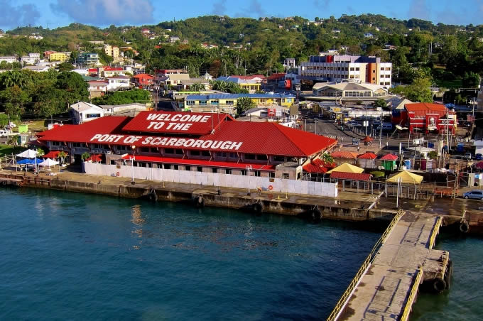
Scarborough

It is the largest city in Tobago, one of the two main islands of the Republic of Trinidad and Tobago. The city is dominated by Fort King George, an 18th-century fortification named after King George III, which now keeps a historical and archaeological museum. Scarborough Deepwater Harbor was built in 1991, before ships were forced to anchor offshore. Scarborough became the capital of Tobago in 1769, when it replaced the then capital of Georgetown. Under French rule it was named Port Louis. The city of Scarborough is the main seat of the Tobago Assembly, which is responsible for local administration in Tobago.